McCroskey to Bald Mountain
Jeremy and I travel from our homes to Farmington, Washington, for some quick riding with our brother Joel around our childhood stomping grounds north of Moscow Mountain.

Long Valley cows
“Wow, just looked at the calendar and realized that’s this weekend,” Jeremy wrote with amusement. His surprise characterized our relative lack of planning for a quick, spring brother ride in North Idaho.

Taking turns
I hitched the small folding trailer to my equally small car, a sight many find amusing, and headed north from Boise with two white motorcycles in tow, mine and the TW for Jeremy.

White Bird challenge
This time I knew the baby hippo, my Chevy Aveo commuter car, would do just fine pulling a load up the long White Bird grade. I did the same thing ten months ago.¹ I face the hill with confidence.
- Trail Image, “Brother Ride 2013: A Night in Pierce”: http://trailimage.com/brother-ride-2013

Starting to turn
Rapeseed crops (in the mustard family) in the low hills around Idaho’s northern Camas Prairie are turning bright yellow. I roll down windows and let the aroma swirl around me. It’s a beautiful time of year to wind through Palouse Hills.

Rapeseed bloom

Motorcycle maintenance
After our six hour drives, Jeremy and I join Joel for minor maintenance before we ride — new brush guards and mirrors for the KLR and a new pipe for the TW. We are spoiled with coffee and epic sweet onion hash browns from Jill — makes me want to come here every time I need to work on the bike.

Fireside
Our mom drives over from her little farm near Troy to spend the evening with us around a fire. We notice overhead condensation trails from passing jets and joke about conspiracy theorists’ chemical mind control concerns.
I suggest, unimaginatively, that the nearby Spokane airport likely means there are standard jet routes above and later confirm airways J52, J90 and J500 make a tight triangle around Farmington.¹ There will always be contrails in their sky … to say nothing of the McCroskey sasquatch.

We are slow the next day to finally mount up and head over Skyline Drive toward Laird Park. Jill makes the final preparation, a shot for Facebook, then we’re off.
- Facebook, “Jill Abbott”: https://facebook.com/photo.php?fbid=10204058159485355&set=p.10204058159485355&type=1&theater

Wild roses

Frills
The upper elevations of McCroskey Park are a flower garden. Below, green crops cover famously fertile hills stretched to the horizon. Glorious.

Pink rockets

Green blanket

Skyline Drive

Trimbling
Jealous, I think, of Joel’s and my GPS units, Jeremy is playing with the Trimble phone app¹ to view topographic maps and track our route. “I feel like part of the group, now,” he says.

Backcountry


Marsh tavern
We stop at a cabin built with local materials by James G. Marsh as a tavern in 1934. In 1940, the tavern moved to a larger building and the cabin became home to James’s mother Lettie, where she lived until 1953. Decades later, in 2004, the cabin was moved a short distance to make room for the Highway 95 improvement project.¹
- From on-site signage provided by Mrs. Lois Swinney, daughter of James Marsh

Highway 95 on Marsh Hill

Below Meadow Creek Road
The GPS route that was “just an idea,” not well vetted, is the line we follow religiously from McCroskey to highway to gravel, now dirt between encroaching, clutching branches. Occasional, deep puddles are an additional obstacle.

That is not the way
In spite of its mud and brush, the trail has continued unabated until now. We don’t see a way around a row of down trees, though. After a moment to clamber, we see the large trees have been stacked strategically for some distance along the edge of a current logging operation.
Such encounters aren’t unusual up here where much of the forest land is owned by timber companies. Potlatch Corporation, for example, owns “more than 792,000 acres in northern Idaho.”¹ Our 2008 ride route was thwarted by logging.² Today, armed with GPS units, I think we can find another road to get us through. Jeremy is already scrutinizing Trimble.
- Potlatch Corporation, “Our Idaho Timberlands”: http://potlatchcorp.com/IdahoTimberlands.aspx
- Trail Image, “Brother Ride 2008: Camping with Cows”: http://trailimage.com/…/camping-with-cows

A million daisies
A return to the gravel and a moment to consult our gadgets finds an easy alternative above the logging. We descend a narrow, dustless road along upper Meadow Creek. Flowers of all shapes and colors line the road. I stop for pictures then hit the hyper-drive — colored points of light blurring into lines around me — to catch up. What a beautiful blast.

Meadow Creek
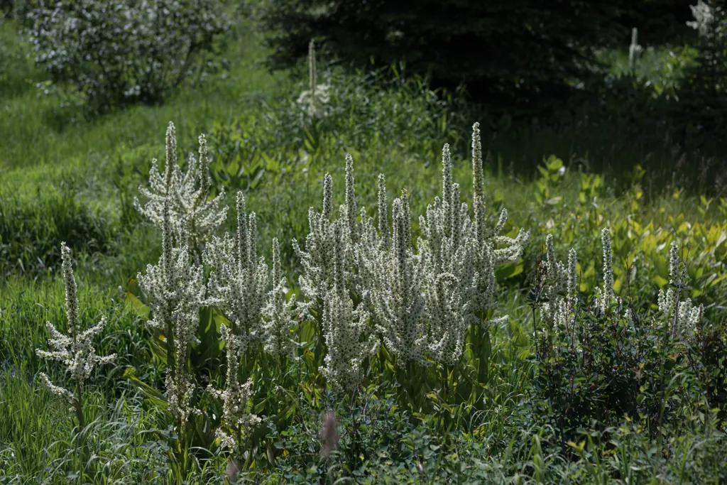
Happy bees

Smith Meadows
“I wonder why no one is camped here,” Jeremy muses. We’re stopped near a large campsite at the edge of Smith Meadows. We’ve passed several campers at lesser spots.
“Cowpies?” Joel suggests. “It smells.”
“Too many cowpies,” I agree. It’s inviting from a distance but up close you can see the ground covered in cow poop. We know, unfortunately, what that camping is like.¹
- Trail Image, “Brother Ride 2008: Camping with Cows”: http://trailimage.com/…/camping-with-cows

Highway 6
We have another short stint on the highway before turning toward Laird Park. “I’ve been there a million times,” Joel says to vote against entering the park itself.

Palouse slime
Instead of the park, we find a shaded area farther up the Palouse River where we stop, rinse our faces in the cold water and have a snack.

Old stump

Joel’s snack

Stand out

Strychnine Ridge Trail 319
Joel seems as hesitant as Jeremy is excited to turn off the gravel road along Strychnine Creek to ATV Trail 319. But it’s what the GPS says to do. We must obey.
Tight switchbacks are a chore with the KLR’s tall gearing but the trail is otherwise friendly. No dangers, ruts or rocks. Jeremy is leading and I’m tailing but the few times I catch sight of him, he’s blasting over the occasional whoops, trying to get the TW airborne.

Patchwork
From the clearing atop Little Bald Mountain we can see the surrounding patchwork of clearcut, new growth and not-as-new growth forests (there’s no old growth left anywhere). It makes the mountains look like features in a poorly drawn video game.

Whereas many southern Idaho towns were formed by gold rush, populations quickly ballooning and deflating, the oldest towns up here come from timber. Their growth and demise chart a slower course, many, like our hometown, still lingering around these North Idaho counties.
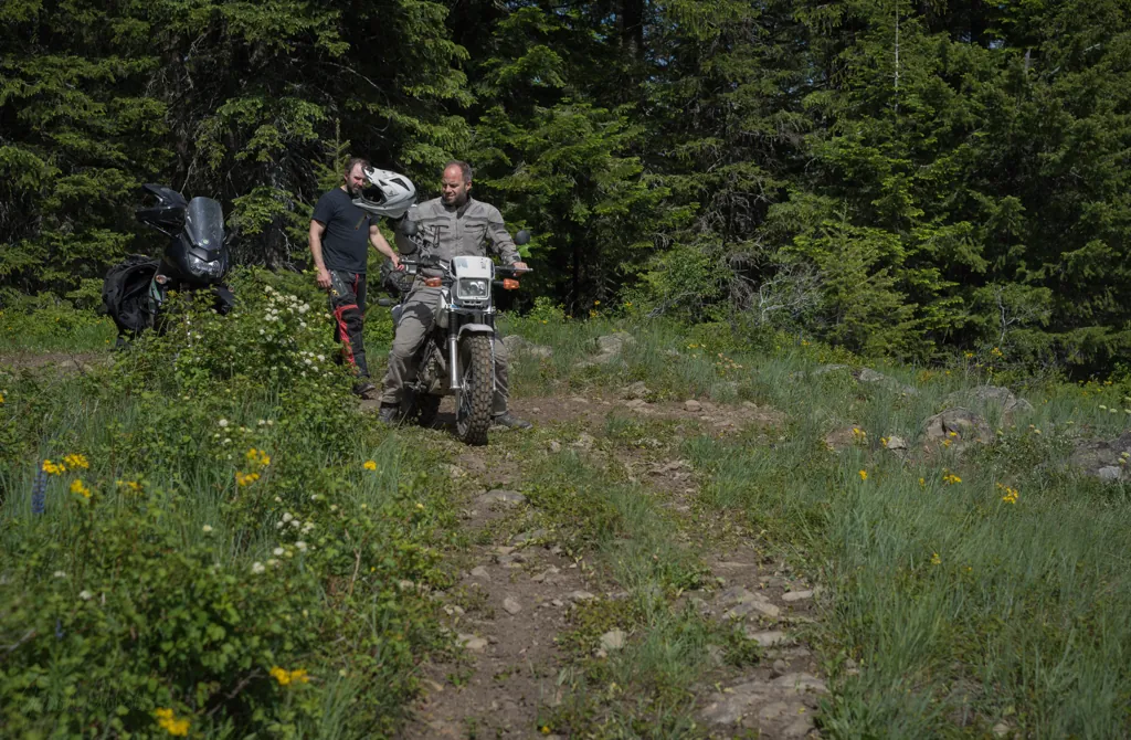
Little Bald Mountain


One mile

Bald Mountain Lookout

No name or date

Bird’s eye


From the Palouse Divide
Smell differs from my other senses. Whereas I dream of sights and sounds, and can readily imagine them, my dreams are odorless. I can’t conjure a smell in my mind the same way I can visualize a memory.
Perhaps that is why I find poignancy in familiar smells. They come unexpected, unimagined. The western Oregon woods are like that (I lived there kindergarten through second grade). So are these northern Idaho woods. The unique smell of pine, cedar, loam and flowers strikes a familiar chord.

Boundaries

Meadow Creek Loop Ski Trail
We descend from Bald Mountain to the easy-going gravel of Palouse Divide Road. A trailhead sign along the way indicates a “hardest” trail and Joel says he doesn’t mind waiting while I take a run at it.
“Come on, Jeremy,” I call but he’s decided to have a break with Joel. I rip into the woods maybe a mile but find nothing harder than a gentle path. Darn. We realize the sign must pertain to skiing, not riding.

Cedars
We cross back over Highway 6 to follow Dennis Mountain Road toward De Smet. It is nicely tractable, interspersed with deep shade and wide vistas that lull us into a casual disposition. And suddenly Joel is in the ditch, holding his still helmeted head.

One down
It didn’t take much. We’ve come upon another logging operation. The roadway’s soft earth is rutted by heavy machinery. Joel’s front tire caught the edge of a rut just as he was studying one of the impressive tractors.¹ Totally understandable. Practically inevitable.
After a few minutes, Joel and the KLR are fine. “Better not tell Jill,” we agree.
- Pine Creek Logging: https://facebook.com/PineCreekLoggingLlc

Modern machinery

When I was 14*
From treed hills above the De Smet Indian reservation, we descend to the gravel Sanders Road. A wood sign along the way indicates Camp Sanders¹ to our right. I glance over and am surprised to see myself twenty-seven years ago. I didn’t know that was here.
In 1988 I was allowed to miss part of church camp there at Sanders to take my final driver’s test. In a gathering of teens on the last night of camp, I was burdened to confess sinful priorities, driver’s license before church.
Sinful things like popular music and wanting to ride faster than the speed limit were always leading me astray, reminding me I was condemnable. So it didn’t feel unusual.
And there was a girl. We talked a little. I didn’t know much about the gender, and still don’t, but she seemed nice so when I got home, I asked my mom to take some heroic pictures of me on my motorcycle to include with a letter. I never heard back.
In a moment the camp recedes again into the distance.
- Heroic photo by my mom, Cheryl Reed
- Camp Sanders: http://campsanders.com/

Rinse
Jeremy so enjoyed the TW when he used it for last year’s big ride,¹ he’s decided to buy it. It’s going home with him, clean apparently … which I guess means I get to start thinking about another big bike. Maybe an 1190 Adventure R?
- Trail Image, “Brother Ride 2013”: http://trailimage.com/brother-ride-2013

Zero turn
“Zero turn mowers are freakin’ incredible,” Joel had said. So obviously Jeremy and I have to see this thing before we leave.

Rodeo
Joel lets us take turns on the mower. Jeremy gets a little rodeo going around a coffee cup on the ground. The show is over after he tries it in reverse.
Then it’s good-byes and time to plan the big Labor Day ride. Thanks for hosting us, Joel. We had a Farmington-good time.