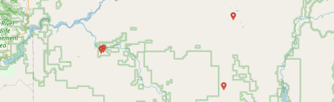
My oldest daughter and I set out late in the afternoon across the Oregon Trail by Bonneville Point to Blacks Creek, up to Prairie, over House Mountain road then up to Trinity and down to Anderson Ranch Reservoir via Featherville to Mountain Home and home. ___ ¹ Trail Image: http://www.trailimage.com/bad-day-at-danskin

My oldest daughter and I set out late in the afternoon across the Oregon Trail by Bonneville Point to Blacks Creek, up to Prairie, over House Mountain road then up to Trinity and down to Anderson Ranch Reservoir via Featherville to Mountain Home and home.


Our ride took us across the Oregon trail and up along the Boise River.


Riding up to Prairie and over House Mountain with the sun at our backs was a real pleasure, everything set in stark relief by the golden light.

We stopped only briefly to turn around and take in the view. I wanted to make our destination before darkness.

The ride up Trinity Mountain road was awesome. The sky to our left was pink and orange with the setting sun, the surrounding landscape was stunning, there was no traffic, temperatures were perfect and the trail was technical enough to keep it interesting.
I slowed enough at a gate to read that automobiles were prohibited but motorcycles and ATVs could continue up the full 9,500 feet. So up we went. As the sunset gave way to a moonless night, the GS fog lights were a nice help picking a good route amidst that final rocky climb. I had a tripod and other photo gear in our pack that I saw could soon be put to great use.
With little fanfare, we achieved the little parking spot by the lookout. Then we got yelled at. I guess I should have continued reading the signage at the gate. We weren’t supposed to be up there after 6:00 PM. Darn. No loitering. No pictures. Back down we went.

I had some dirt routes in mind but to expedite our return, I decided to go straight for highways (happy to be on the GS at that point). We descended the other side of Trinity by the lakes we couldn’t see towards Featherville. We were averaging about 30 MPH on the winding dirt road so I was dismayed to see “Pine 28 miles.” That works out to how long?
A turn off got us over to Featherville a little sooner but it was still a long ride home. But comfortable. There’s no comparison to what it would have been like on my XRL. My daughter leaned back against the pack and watched the stars while I clicked on the heated grips as we twisted over the hills and through chilly valleys towards home.
by Jason Abbott